50 Innovative Companies to Watch 2022
Orbital Net – Leveraging State-of-the-Art IT Solutions and Services That Utilize Foss4g and AI Technology
The Silicon Review
"The AI solutions provided by Orbital Net generate something that has never been done before, from aerial and satellite imagery, at high speed and in large volumes."
Orbital Net is a leading geospatial solution vector that leverages cutting-edge AI-based geospatial analysis technology that utilizes FOSS4G (Free Open Source Software for Geospatial). The company primarily aims to boost the business field of AI and geospatial analysis, which will play a pivotal role in sustainable regional development, such as management, natural disaster countermeasures, environment, and energy management, based on the data collected in large volumes using AI technology.
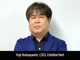
Yuji Kobayashi, CEO of Orbital Net, spoke exclusively to The Silicon Review on how his company enables clients to use satellite imagery to generate maps and map elements using AI.
Interview Highlights
Q. How unique is Orbital Net, and where does it stand at the moment relative to other participants in the industry?
Orbital Net provides IT solutions in the business domain of mapping, surveying, and construction consultancy. For many years, the company has been developing business support systems and providing production tools using open source software called FOSS4G (Free & Open Source Software for Geospatial), which specializes in the use of maps. In this context, we began to utilize AI at an early stage. Orbital Net believes that the biggest advantage of using AI in this field is its overwhelming processing speed and aims to replace tasks that were previously performed manually, such as aerial photo deciphering. Consideration for the introduction of AI technology begins with the output of the company's thinking about what AI can do. After demonstrating its usefulness to the market, the company is commissioned to carry out work using AI-implemented tools. Based on actual in-house use, improvements are made in consultation with the client.
Most AI businesses in the surveying and construction consultancy field come from AI specialist companies, so to speak, from other fields. However, based on our experience in the surveying and construction consultancy field, we are always thinking about what AI can solve, and we want to create products that we can offer with confidence.
Q. What are the various solutions Orbital Net offers? What can you tell us about geospatial solutions in particular?
Orbital Net is developing two businesses, FOSS4G solutions, and AI solutions. Together, these two are called geospatial solutions.
FOSS4G solutions utilize open source geospatial software to support operations dealing with customer information, land, and facilities. In particular, we specialize in customizing the open source desktop GIS "QGIS" for our customers and developing plug-ins. We also have a range of products, including a 'Fixed Asset Business Support System' for local governments.
AI solutions use deep learning to extract and process necessary data and general location information from data such as satellite images, aerial images, and in-vehicle video for projects such as mapping, regional analysis, civil engineering design and construction, and infrastructure maintenance and management. Extraction results can be deployed in geospatial space using GIS to perform geospatial analysis. In an unusual example, AI also enables the filtering of 3D point clouds acquired by aerial laser surveying.
We also have "Geo Detector", an inference engine specializing in detecting geographic objects, and "Geo Tracer", which specializes in extracting the geometry of geographic objects.
"Geo Detector" is built on Object Detection and obtains results in terms of points and rectangle geometry.
"Geo Tracer" is built on "Instance Segmentation" and "SRGAN" and outputs geometry such as map elements of roads and buildings, land zonings such as landslides and land use, geometry such as parking lots and mega solar panels, and geometry of small ancillary facilities such as solar panels on roofs. The output is geometry.
Q. Setbacks are a part of every growing business. Tell us about a few roadblocks and learning lessons that helped Orbital Net grow through the years.
Orbital Net was founded as a spin-off from the IT sector, with investment from a local surveying and design company. At the time, the company was tasked with subcontracting work to the parent company while using the profits to fund new developments, which would be returned to the parent company in the future as indigenous technology.
However, in the third year of the company's existence, the parent company changed its management policy, and Orbital Net was removed from the ladder and had to fundamentally restructure its business policy. Therefore, a 'management buyout' was conducted, and Orbital Net took over management rights from the parent company and became completely independent, making a fresh start two years ago as the newly-formed Orbital Net. We had to manage the company, taking on new risks without being prepared for the acquisition of new customers, fundraising, and the development of our own products. Then came the new coronavirus pandemic. At first, there was no way to win customers, but we reopened our doors and worked steadily on product development. Eventually, communication methods for the coronavirus pandemic were established. As a result, the coronavirus successfully attracted customers online, and the systems and tools we steadily developed became the backbone of our AI solutions business operations today.
Q. Will Orbital Net be expanding, bringing on any new solutions we should be aware of?
Regarding the introduction of new solutions, an AI application has been developed to super-resolved aerial and satellite imagery. It uses AI to perform super-resolution processing from low-resolution images, resulting in amazing clarity. High-resolution images are rare and expensive. Sharper images also allow for more detailed objects to be seen. Super-resolution solutions offer a number of advantages.
As a new business development, we will provide new AI solutions for the construction industry. We have developed a web service for on-site visual inspections at a major construction company. This groundbreaking AI solution reduces the time required for the inspection process to less than 1/10th of the current time. In the near future, we intend to offer this as a web service for the construction industry.
Q. How do you see Orbital Net changing in five years, and how do you see yourself creating that change?
The AI solutions provided by Orbital Net generate something that has never been done before, from aerial and satellite imagery, at high speed and in large volumes. As the content cannot be generated manually, it naturally generates added value. We want to transmit this content from our website using FOSS4G technology, which is one of our specialties. We are also working to develop the AI solution itself into a web service so that it can be completed online. We will switch our business model from a contract-based business model to one centered on online map content services and AI applications and services.
We are currently positioned as a geospatial and AI solution vendor, but we hope to develop the market as a provider of AI-generated DATA in the future.Orbital Net.
"We have developed a web service for on-site visual inspections at a major construction company. This is a groundbreaking AI solution that reduces the time required for the inspection process to less than 1/10th of the current time."
MOST VIEWED ARTICLES
RECOMMENDED NEWS


TOP NEWS
YOU MAY ALSO LIKE


_2025-11-17_06-38-14.webp)