>>
Other>>
Others>>
How Commercial Satellite Image...How Commercial Satellite Imagery Aids in Wildlife Conservation
The Silicon Review
18 November, 2024
Author:
The Silicon Review Team
Preserving biodiversity has garnered significant attention, especially with the help of technological tools that support conservation efforts. One such tool that is making a profound impact in this area is satellite imagery.
These advanced technologies empower conservationists by allowing them to monitor vast areas of land, track environmental changes, and gather crucial data that directly support their efforts to protect ecosystems and wildlife. By providing a birds-eye view of the Earth's surface, commercial satellite imagery solutions are transforming how conservationists address global biodiversity challenges.
Understanding Satellite Imagery
Satellite images are captured from space, showing the Earth's surface from above through sensors installed on satellites that orbit our planet. These sensors detect light, heat, and various electromagnetic waves, which are then processed into high-resolution images that provide valuable insights into land use, vegetation health, climate patterns, and human activities. By monitoring these images over time, conservationists can track changes in the environment and assess the health of ecosystems with great accuracy, a vital resource for wildlife protection.
Monitoring Habitat Health
Habitats serve as the foundation for countless species, providing the necessary resources for animals to thrive. Monitoring these habitats is essential to preserving biodiversity, as any disruption can have far-reaching consequences. Satellite imagery allows experts to track various factors that influence habitat health, such as vegetation changes, water availability, and human encroachment. By studying these images, conservationists can identify signs of habitat degradation or destruction—whether due to urbanization, agricultural expansion, or natural disasters—much more efficiently than traditional on-the-ground methods.
Tracking Wildlife Movements
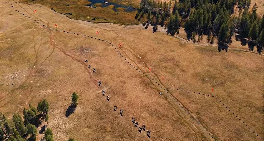
Understanding wildlife migration patterns and seasonal movements is another critical aspect of wildlife conservation. Many species, including migratory birds, marine animals, and large mammals, travel long distances across regions to find food, shelter, and breeding grounds. Satellites play a pivotal role in tracking these movements, as they enable conservationists to monitor animal behavior on a global scale.
By using GPS tags and satellite collars, scientists can track individual animals or even entire populations. This data helps identify migration routes, stopover points, and the environmental factors that influence movement. More importantly, it also highlights areas where animals may face significant threats—such as barriers to migration, human settlements, or environmental changes. Mapping these routes ensures that conservation efforts can focus on protecting key areas along these migratory paths, thus ensuring safe and successful journeys for wildlife.
Detecting Illegal Activities
One of the most significant threats to wildlife conservation today is illegal activities such as poaching, deforestation, and habitat destruction. Detecting and halting these activities can be incredibly difficult, especially in remote and protected regions. However, satellite imagery provides an invaluable overhead perspective that can be used to spot these illicit actions from space.
Assessing Climate Change Impact
The effects of climate change on wildlife and their habitats are becoming increasingly apparent. Rising temperatures, changing precipitation patterns, and extreme weather events all disrupt the natural balance of ecosystems. Satellite imagery plays a crucial role in monitoring these climate changes and understanding how they affect biodiversity.
By analyzing satellite data over extended periods, environmentalists can track changes in vegetation, water levels, and temperature. These insights help determine how climate change is altering ecosystems and what measures need to be taken to mitigate its impact on wildlife. For example, shifts in temperature may alter the timing of plant blooming or animal migrations, disrupting the delicate balance that many species rely on. Understanding these trends through satellite imagery allows for developing targeted conservation strategies to help species adapt to changing environments.
Supporting Reforestation Efforts
Reforestation is essential for restoring ecosystems and rebuilding habitats that have been damaged by deforestation, urbanization, or natural disasters. Satellite images are invaluable in identifying areas that need reforestation, monitoring the progress of tree planting initiatives, and assessing the success of these efforts over time.
Using satellite data, conservationists can track the growth of newly planted forests, measure changes in vegetation cover, and identify areas that may require additional restoration efforts. This technology helps optimize reforestation strategies, ensuring that trees are planted in the most suitable locations for wildlife and that they thrive in the long term. By providing real-time data on forest health and growth, satellites also support the ongoing monitoring of reforestation projects, ensuring that they meet their ecological goals.
Enhancing Collaboration Among Stakeholders
Effective conservation requires collaboration among various stakeholders, including government bodies, nonprofit organizations, researchers, and local communities. Satellite imagery plays a vital role in facilitating communication and data sharing among these groups. By providing a shared platform for monitoring environmental changes, satellite images help ensure that all parties involved are working with the same information and can coordinate efforts more effectively.
Conclusion
Satellite imagery has revolutionized wildlife conservation by providing valuable insights into the health of ecosystems, tracking animal movements, detecting illegal activities, and assessing the impacts of climate change. While challenges remain—such as the cost of accessing high-quality images and the need for specialized expertise—the benefits far outweigh the limitations.